

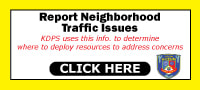
* TRAFIC CIRCLE & CURB EXTENTION INSTALLATION:
10/19/22 UPDATE
Below are additional questions (and answers via email from the city's Sr. Civil Engineer in quotes) about these traffic calming tools to slow down neighborhood traffic to make it a safer place for us to live, drive, walk, ride bikes, etc.:
1) Are these a temporary test or can we consider them permanent?
2) Are the bollards [white posts] permanent or simply temporary until people get familiar with the curbs?
“In general terms, we look at the street typology, function, target speed limit, and design to evaluate what measures are needed to meet calming goals. Speed humps for instance aren’t the safe option on a sloped street, higher speed street, or commercial street most often. Other things to consider are geometry, pavement condition, and available funds.”
“As always, we understand this is significant change. The best thing to do is communicate the TRIAL and PILOT nature of the recent installations. The City is open to adjusting and adapting the calming measures. However, we have to have time for traffic to settle, people to get use to it, and then make changes based on that. Basically, we need to give time for the items to work/not work before making adjustments.”
“We are monitoring this closely and I have been driving the area from multiple angles and direction several times a day since we’ve started the installations.”
ALSO - see the graphics (from the city) HERE to better help you visualize the final product.
10/19/22 UPDATE
Below are additional questions (and answers via email from the city's Sr. Civil Engineer in quotes) about these traffic calming tools to slow down neighborhood traffic to make it a safer place for us to live, drive, walk, ride bikes, etc.:
1) Are these a temporary test or can we consider them permanent?
- “The curbs are temporary and are being used as a TRIAL and to TEST how effective curb radii and mini-roundabouts are before we do anything permanent. However, we do have to have a long enough time to study effects, so they will be in place for an anticipated 18-36 months depending on the area and resources we have available. The trial period will help inform design changes for these areas and also gives us a starting point to understand how these measures affect traffic as we look to calm traffic in neighborhoods City wide.”
2) Are the bollards [white posts] permanent or simply temporary until people get familiar with the curbs?
- “Bollards are planned to remain in place while the temporary curb is in place. However, we do plan to reduce the amount to only a handful per curb radii once traffic gets used to them being there”
- “Clearing snow around the curb extensions and traffic circles will take place as usual, getting the snow of the road. Radii were designed to allow for them to be cleared. Inside the elements will be a different matter. For the traffic circles there wouldn’t be much of a need to clear inside during the winter months. For the curb extensions, I’d imagine we’d treat these as similar to sidewalk ramps as an “extension” of the ramp area. So they’d be cleared like sidewalk would be.”
- “Painting of the curbs themselves would not be permissible. They are retroreflective and are made to be reused/reinstalled in other trial areas after the trial in Winchell. So, the City will not permit them to be painted.”
- “We would be open to providing temporary encroachments for landscaping within the circles and painting in the curb extensions. Our ROW Coordinator can work with the neighborhood association or individuals if this is desired and can help process the required paperwork and provide the requirements for items placed (colors, height of landscaping, type of material, etc.)
“In general terms, we look at the street typology, function, target speed limit, and design to evaluate what measures are needed to meet calming goals. Speed humps for instance aren’t the safe option on a sloped street, higher speed street, or commercial street most often. Other things to consider are geometry, pavement condition, and available funds.”
“As always, we understand this is significant change. The best thing to do is communicate the TRIAL and PILOT nature of the recent installations. The City is open to adjusting and adapting the calming measures. However, we have to have time for traffic to settle, people to get use to it, and then make changes based on that. Basically, we need to give time for the items to work/not work before making adjustments.”
“We are monitoring this closely and I have been driving the area from multiple angles and direction several times a day since we’ve started the installations.”
ALSO - see the graphics (from the city) HERE to better help you visualize the final product.
* TRAFIC CIRCLE & CURB EXTENTION INSTALLATION:
10/7/22 UPDATE
Below are questions to the city along with the Civil Engineer's answers (in quotes).
This is a process that will be completed shortly, but it will take a bit of time and patience from our neighborhood before implementation is complete. Again, the overall goal here is to slow down neighborhood traffic to make it a safer place for us to live, drive, walk, ride bikes, etc.
ALSO - see the graphics (from the city) HERE to better help you visualize the final product.
1) How long it will take to complete the installation? (the rubber curbs, in-street arrows & bike symbols, yellow painted lines, painted “islands”, etc.?)
“The rubber curbs are new items to us (the city) and the Contractor. Install speed/timeframe is not yet known. We expect it will take 2-5 days to be fully installed at ALL locations (including the curb extensions).”
“Installation of the curbs will start Monday 10/10."
“Paint and other items to occur once that Contractor is in the local area (end of October/beginning November is expected).”
2) Will these be monitored (and if so, by who, and how?) for their effectiveness and ease of use?
“Public Services will monitor the operation of the traffic circles. We took before traffic speeds and volumes and will compare them against the post-installation speeds and volumes once traffic normalizes, which will occur in 2023.”
3) Can/will these be changed if warranted? What would warrant them being changed?
“These can be changed if warranted. Public Services selected modular rubber curbs that could be removed, moved, added to, or changed if absolutely required.”
4) Will busses and big trucks be able to go through these traffic circles safely and effectively?
“These are all designed per the City of Kalamazoo Streets Design Manual to accommodate the appropriate vehicles for the road type. I personally watched school buses, one transit bus, 1-ton truck/trailer combos (x2), and garbage trucks (x2) navigate the circles without an issue this morning. Lane widths and roundabout locations were picked with snow clearing and leaf clearing in mind as well. It just made everyone slow down going through the intersection – exactly what they were meant to do.”
* Bike Lanes Explained
09/09/22 Update
The main responsibility of the Oakland Drive/Winchell Neighborhood Association (ODWNA) board is to represent the interests of the neighborhood at-large.
We do that through the goals of our Neighborhood Plan, which was created after 2+ years of research, meetings, surveys, and conversations with hundreds and hundreds of our neighbors, and also working closely with city staff to ensure that those goals align with the overall Master Plan vision. The Plan was approved by the City Commission in June 2020 and is officially a part of the City’s Master Plan. You can find a link to it on our website: www.WinchellNeighborhood.org
Two top neighborhood goals identified were traffic calming and creating more non-motorized transportation networks (bike lanes & pedestrian walkways. Bike lanes work to satisfy both goals.
This issue of parking on Winchell Ave. by the preserve has been brought to our, and the city’s, attention by a small group of people various times over the last few months. See the letters by the City Planner and our Association’s board which address this issue and explains the rationale for a non-interrupted bike lane on Winchell Ave. from Oakland Drive to Winchell Way Apartments.
You can also see HERE multiple research articles that show:
1) The dangers of allowing parking in bike lanes, and
2) Overall benefits of creating bike lanes.
Our board understands not every resident will agree with every decision that is made, or action implemented, and that every decision can adversely affect a small group of residents. We believe the main responsibility of the ODWNA board is to serve the greater goals of the neighborhood, as identified through our Neighborhood Plan, and we believe (as does the city) these bike lanes satisfy this responsibility.
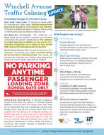
* Changes Made to Winchell Avenue!
October 2021 - Traffic Calming & Added Bike Lanes
The ODWNA continues to work with the city on implementing the goals and actions of our Neighborhood Plan. “Increasing Traffic Safety” was ID’ed as one of the neighborhood’s main goals.
To that end, major changes have been made to Winchell Avenue:
See the flyer HERE for information and upcoming projects that fulfill our Neighborhood Plan goals and help make our streets safer for ALL users!
Note that this initiative aligns with the ODWN Neighborhood Plan Connected Neighborhood section, "Increasing Traffic Safety"
October 2021 - Traffic Calming & Added Bike Lanes
The ODWNA continues to work with the city on implementing the goals and actions of our Neighborhood Plan. “Increasing Traffic Safety” was ID’ed as one of the neighborhood’s main goals.
To that end, major changes have been made to Winchell Avenue:
- Lanes are reduced in size to 11 feet in both directions to help slow traffic
- Painted bike lanes are installed in both directions for increased connectivity and to help calm traffic (bike lane signs & in-lane markings to come).
- On-street parking has been removed from Winchell Ave.(stopping/standing during Winchell Elem. pickup and drop-off will be allowed)
See the flyer HERE for information and upcoming projects that fulfill our Neighborhood Plan goals and help make our streets safer for ALL users!
Note that this initiative aligns with the ODWN Neighborhood Plan Connected Neighborhood section, "Increasing Traffic Safety"
AUGUST 2021 - UPDATE
Winchell Ave./Rambling Rd. Stop Sign
Eastbound Sign Installed!
In case you haven't noticed, the City has installed a STOP sign on eastbound Winchell Ave. at Rambling Rd. In an email to the Association from Fred Nagler, City Engineer, he told us, "The installation will include an advanced warning sign that will be taken down after regular road users are accustomed to the new sign. Engineering will monitor the function of the intersection and evaluate the efficacy/safety of the new configuration after approximately six months. In addition, we will continue to study geometric changes that might be made to address concerns expressed by neighborhood residents."
Thank you to all who supported this effort by the ODWNA to help make that intersection safer for pedestrians, bikers and drivers. If you have any further thoughts or comments regarding that intersection, feel free to email us at the Association or the City Engineer directly here.
We will continue to monitor the situation with the City and inform you of any updates as we receive them.
______________________________________________________________
ODWNA ~ P.O. BOX 20061 ~ Kalamazoo, Michigan 49019
ODWNA ~ P.O. BOX 20061 ~ Kalamazoo, Michigan 49019